Property Record
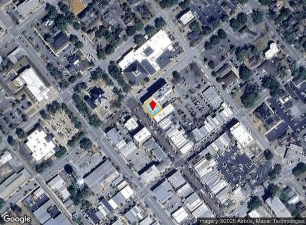
132 N Broad St, Thomasville, GA 31792
NEARBY LISTINGS FOR SALE OR LEASE
Property Detail
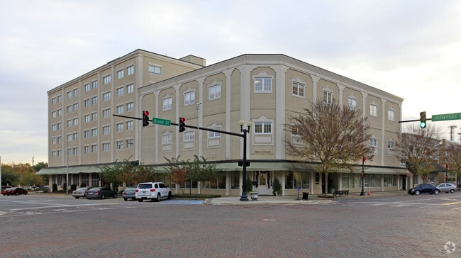
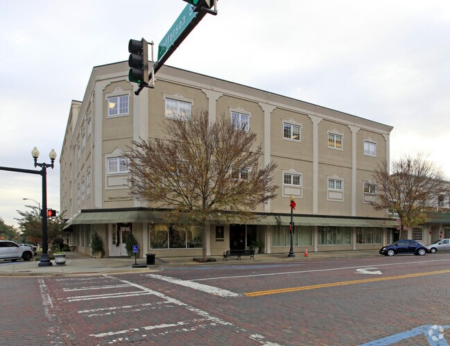
132 N Broad St
005-015028-B
132 N BROAD ST /120 JEFFERSON ST SHIELDS & CO
Officebuilding
Thomas
X
Georgia
13275C0228D
39
0
0.19 AC
2024
Albany/Southwest
960702
Other Market Areas
23,883 SF
Thomasville, GA
DEMOGRAPHICS near 132 N Broad St
1 Mile
3 Mile
5 Mile
2024 Total Population
5,807
24,339
30,627
2029 Population
5,897
24,442
30,697
Pop Growth 2024-2029
+ 1.55%
+ 0.42%
+ 0.23%
Average Age
41
40
40
2024 Total Households
2,435
10,077
12,479
HH Growth 2024-2029
+ 1.56%
+ 0.43%
+ 0.24%
Median Household Inc
$41,955
$51,361
$53,833
Avg Household Size
2.30
2.30
2.40
2024 Avg HH Vehicles
2.00
2.00
2.00
Median Home Value
$157,572
$174,540
$182,595
Median Year Built
1972
1980
1984
Nearby Places
Map Layers
Map Styles
 Street
 Aerial
- Restaurants
- Banks
- Shops
- Fitness
- Groceries
PUBLIC TRANSPORTATION
AIRPORT
Tallahassee International
DRIVE
WALK
Distance
Tallahassee International
61 min
42.7 mi
Nearby Properties
Address
Land Use
TOTAL SIZE
Lot Size
Zoning
Address
Land Use
TOTAL SIZE
Lot Size
Zoning
178,227 SF
16.73 AC
C-1
Address
Land Use
TOTAL SIZE
Lot Size
Zoning
327,147 SF
106.07 AC
AG
Address
Land Use
TOTAL SIZE
Lot Size
Zoning
271,000 SF
95.80 AC
R1
Address
Land Use
TOTAL SIZE
Lot Size
Zoning
43,476 SF
18.60 AC
RM11
Address
Land Use
TOTAL SIZE
Lot Size
Zoning
117,638 SF
1.89 AC
C-2
Address
Land Use
TOTAL SIZE
Lot Size
Zoning
16,104 SF
48 AC
M
Address
Land Use
TOTAL SIZE
Lot Size
Zoning
72,404 SF
3.79 AC
C-2
Address
Land Use
TOTAL SIZE
Lot Size
Zoning
12,265 SF
39.66 AC
AG
Address
Land Use
TOTAL SIZE
Lot Size
Zoning
6,087 SF
34.01 AC
R1
Address
Land Use
TOTAL SIZE
Lot Size
Zoning
145,231 SF
13.95 AC
M
Address
Land Use
TOTAL SIZE
Lot Size
Zoning
37,211 SF
4.55 AC
C-1-LU
Address
Land Use
TOTAL SIZE
Lot Size
Zoning
83,919 SF
24.59 AC
R-1A
Address
Land Use
TOTAL SIZE
Lot Size
Zoning
40,922 SF
9.80 AC
AG
Address
Land Use
TOTAL SIZE
Lot Size
Zoning
273,600 SF
24.99 AC
M
Address
Land Use
TOTAL SIZE
Lot Size
Zoning
67,454 SF
31.60 AC
R-2
Address
Land Use
TOTAL SIZE
Lot Size
Zoning
145,230 SF
17.23 AC
C-1
Address
Land Use
TOTAL SIZE
Lot Size
Zoning
1,560 SF
23.96 AC
M
Address
Land Use
TOTAL SIZE
Lot Size
Zoning
69,050 SF
47.74 AC
AG
Address
Land Use
TOTAL SIZE
Lot Size
Zoning
188,831 SF
18.52 AC
C-2
Address
Land Use
TOTAL SIZE
Lot Size
Zoning
63,280 SF
9.85 AC
C-1
Address
Land Use
TOTAL SIZE
Lot Size
Zoning
45,196 SF
3.31 AC
C2-CU
Address
Land Use
TOTAL SIZE
Lot Size
Zoning
44,801 SF
3.97 AC
C-2
Address
Land Use
TOTAL SIZE
Lot Size
Zoning
169,359 SF
21.31 AC
C-2
Address
Land Use
TOTAL SIZE
Lot Size
Zoning
12,650 SF
11.68 AC
M
Address
Land Use
TOTAL SIZE
Lot Size
Zoning
150,000 SF
27.32 AC
M
Address
Land Use
TOTAL SIZE
Lot Size
Zoning
57,600 SF
8.30 AC
R-TH
Address
Land Use
TOTAL SIZE
Lot Size
Zoning
600 SF
80.09 AC
M
Address
Land Use
TOTAL SIZE
Lot Size
Zoning
6,138 SF
18.04 AC
R-TH
Address
Land Use
TOTAL SIZE
Lot Size
Zoning
22,048 SF
8.32 AC
M
Address
Land Use
TOTAL SIZE
Lot Size
Zoning
37,512 SF
7.53 AC
R-2
The World's #1 Commercial Real Estate Marketplace
Connect with us
© 2026 CoStar Group
The information above has been obtained from sources believed reliable. While we do not doubt its accuracy we have not verified it and make no guarantee, warranty or representation about it. It is your responsibility to independently confirm its accuracy and completeness. Any projections, opinions, assumptions, or estimates used are for example only and do not represent the current or future performance of the property. The value of this transaction to you depends on tax and other factors which should be evaluated by your tax, financial, and legal advisors. You and your advisors should conduct a careful, independent investigation of the property to determine to your satisfaction the suitability of the property for your needs.